geo markup of photos
I was on a sailing holiday at the beginning of February, ten people on a catamaran in the Carribean. Thanks to sailing, we had an Offshore Navigator on a laptop, recording the positions with a GPS mouse.
Using this GPS track and the photos taken with our two cameras, I was able to create a KML file from the journey. I used some custom PHP code I have written, a little MySQL/PHP/FlickrApi/GoogleMaps hack. It took two days to hack, which is quite nice. Included is a photo annotator to place pictures with some productivity tools (copying the position from one picture to another).
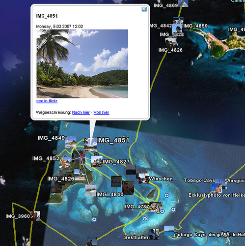
The first result is a Google Earth KML file. It shows the track of the boat and the pictures from Flickr. The other crew members don't have flickr accounts... yet.

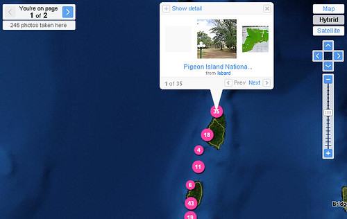
Second, I wrote another script that sets the needed geo-tags on flickr based on the geocoding. See my flickr map.

Now that I have the code, I would love to go on with these things. Is there an open source project which dedicates itself to such mashups? We could also use Chris Bizer and Richard Cyganiaks D2RQ to make a sparql-endpoint for geo positions. Who is in?
Is there an API for plazes.com? So many things to do :-)
Using this GPS track and the photos taken with our two cameras, I was able to create a KML file from the journey. I used some custom PHP code I have written, a little MySQL/PHP/FlickrApi/GoogleMaps hack. It took two days to hack, which is quite nice. Included is a photo annotator to place pictures with some productivity tools (copying the position from one picture to another).
The first result is a Google Earth KML file. It shows the track of the boat and the pictures from Flickr. The other crew members don't have flickr accounts... yet.

Second, I wrote another script that sets the needed geo-tags on flickr based on the geocoding. See my flickr map.

Now that I have the code, I would love to go on with these things. Is there an open source project which dedicates itself to such mashups? We could also use Chris Bizer and Richard Cyganiaks D2RQ to make a sparql-endpoint for geo positions. Who is in?
Is there an API for plazes.com? So many things to do :-)
|
leobard - 3. Mar, 18:42
|
|
- add comment - 0 trackbacks


Trackback URL:
https://leobard.twoday.net/STORIES/3390872/modTrackback